


VICTORIA, Seychelles — Seychelles has approved the creation of a national hydrographic office to improve the country’s knowledge of its vast maritime territory, strengthen navigation and search-and-rescue operations and support planning for its ocean-based economy.
The Seychelles Hydrographic Office will operate as a specialized department within the Seychelles Maritime Safety Authority, bringing together hydrographic information collected by government agencies and international partners.
Cabinet approved the establishment of the office as Seychelles seeks to improve its ability to manage marine data across a maritime domain of about 1.4 million square kilometers.
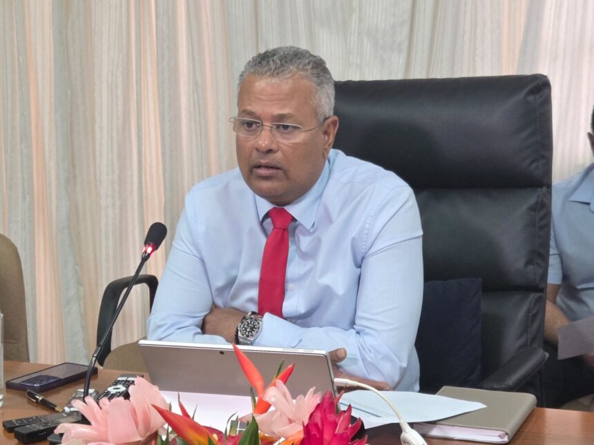
“Hydrography helps us understand the ocean that surrounds us,” said Capt. Daniel Adam, chief executive of the Seychelles Maritime Safety Authority. “If maps help us understand the land, hydrography helps us understand the sea.”
Adam said the office would coordinate, manage and preserve hydrographic information as a national asset and make it available for navigation, search and rescue, marine planning, environmental management and other maritime activities.
Hydrography involves collecting information about the depth and shape of the seabed and other characteristics of the marine environment. Such data is used to produce navigational charts and support decisions about the use and protection of ocean space.
Seychelles has a long history of hydrographic surveying. The islands appeared on early maritime charts centuries ago, while the first recorded hydrographic surveys of Seychelles waters took place in 1742.
Much of the information still supporting the country’s charts comes from surveys conducted before independence, primarily by the British Admiralty.
A more recent survey completed in 2024 through a partnership with the United Kingdom Hydrographic Office generated about four terabytes of data and mapped roughly 650 square kilometers around Mahé, Praslin and La Digue.
That represents less than 0.05% of Seychelles’ maritime domain, underscoring the scale of the surveying challenge.
“Hydrography is never finished,” Adam said. “Some areas have modern survey coverage, while others still rely on older information and would benefit from further surveying.”
He said Seychelles would prioritize areas where updated information is most needed rather than attempting to survey the entire maritime domain at once.
Seychelles has obligations under international maritime agreements, including the International Convention for the Safety of Life at Sea, known as SOLAS, and the United Nations Convention on the Law of the Sea, or UNCLOS, to make appropriate hydrographic information available for maritime safety.
Adam said the country would combine domestic capabilities with international partnerships to meet those responsibilities.
“The important point is that the data collected within Seychelles’ maritime domain remains a sovereign national asset,” he said. “Whether information is gathered directly by Seychelles or through partnerships, the Seychelles Hydrographic Office will coordinate, manage and maintain that information on behalf of the country.”
The office is expected to use a combination of conventional hydrographic surveys and newer technologies, including satellite-derived bathymetry, remote sensing and crowdsourced bathymetry.
Those tools could help Seychelles expand its understanding of its waters without relying exclusively on traditional surveying methods.
The benefits are expected to extend beyond maritime navigation. Hydrographic information can be combined with environmental, meteorological and geospatial data to support marine spatial planning, fisheries management, environmental protection and climate-change adaptation.
The data can also improve search-and-rescue operations and support the tourism and maritime industries.
“Modern hydrography extends far beyond maritime safety,” Adam said. “It is increasingly about marine information and understanding the maritime domain as a whole.”
The government views the initiative as part of its broader efforts to develop its Blue Economy, which encompasses economic activity and sustainable management of marine resources.
“Ultimately, the Hydrographic Office helps transform data about the ocean into knowledge that supports the Blue Economy and helps Seychelles make informed decisions about how we use, protect and manage our marine resources for future generations,” Adam said.
Cabinet approval also provides for the establishment of a National Hydrographic Committee to help coordinate hydrographic activities, manage national data and support cooperation with international partners.
Adam said the office should be viewed as a long-term national capability rather than a project with a fixed completion date.
“Hydrography is not a project with a fixed end date, but an ongoing national capability that will continue to grow as new data, technologies and requirements emerge,” he said.
The new framework will allow Seychelles to progressively update its knowledge of its maritime domain while preserving marine information as a national asset for navigation, safety, environmental management and sustainable economic development.
SUPPORT AFRICAN BUSINESS JOURNALISM
Help XOL Africa expand independent business reporting across Africa.
SUPPORT XOL AFRICA →